The Japan Sea that changes its view for each season;
the mountains that embrace the Shonai plain

This is an off-shore island with a circumference of about 12 km. The average yearly temperature is 12 degrees Celsius, which is the highest in the prefecture, and there are tropical plants growing all over the island that amuse visitors. This island is located at the converging point of warm and cold currents, so it is blessed with an abundance of seafood. It is also well-known as a great spot for fishing, as well as for scuba diving and bird-watching.
Sakata City, Tourism and Local Products Division
 0234-26-5759

The Mogami river is one of the three rapid rivers in Japan, which flows through Yamagata Prefecture to the Shonai plain before it empties into the Japan Sea. It is well-known for haiku poet Basho's poem: It was once a path for transporting goods and commodities; a commercial artery connecting Shonai and other cities inland and of the Pacific side. This mother river nurtures fertile soil of the rice producing region of Shonai.
Shonai Visitors Association
 0235-68-2511

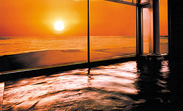
One of the things you cannot leave out when talking about Shonai is the Japan Sea. The coastline with beautiful sand dunes and reefs has been designated as Shonai Seaside Prefectural Natural Park and is a great fishing spot. It is also well-known as a key site for sea-bathing and marine sports and attracts a lot of tourists from other prefectures. The view of the sunset over the sea is a breathtaking beauty.
Tsuruoka City, Tourism and Local Products Division
 0235-68-2511

Mt. Chokai, also referred to as Dewa Fuji (the Fuji of Tohoku), is the Tohoku region's leading mountain which stands on the borders of Yamagata and Akita Prefectures. It rises to a height of 2,236 meters. It attracts many climbers from all over the country with its wealth of alpine flora including Japan's indigenous species. It is also a habitat for the golden eagle, which has been designated as a national protected species.
Yuza Chokai Tourist Association,NPO
 0234-72-5666
Sakata City, Yawata Government Branch, Construction Industry Division
 0234-64-3114

Mt. Gassan is the highest of Dewa Sanzan, the three sacred mountains of Dewa, at a height of 1,984 meters above sea level. It is a beautiful mountain with its gently-sloping ridge. The eighth station of the mountain dotted with marshes commands a glorious view.

Maruike-sama is a pond entirely fed by spring water that originates from Mt. Chokai. The water is a mystical emerald green that slightly changes color depending on the light.
Yuza Chokai Tourist Association,NPO
 0234-72-5886

This graceful fall measures 63 meters high and 5 meters wide. The water falling from the cliff looks like tamasudare (beaded curtain) in the sunshine; hence, the name.
Sakata City, Yawata Government Branch, Construction Industry Division
 0234-64-3114

Yunohama of Tsuruoka City is one of the best 100 sunset spots in Japan. Have a rlaxing moment, sooking in Yamagata’s balneak hot springs while balkinginthe gargeaum sunset’s light by taking advantage of this natural scenic resource: the sunset.

This road was one of the main routes connecting Shonai and other inland cities. Trekking this road, you will be impressed by the beautiful scenery, which shifts with the changing seasons, while feeling the history of the 1,000-year-old Yudono faith.
Tsuruoka City, Asahi Building, Commerce, Industry and Tourism Division
 0235-53-2111

The boat idyllically sails down on the Mogami river, allowing the passengers to enjoy the gorgeous valley.One can enjoy beautiful spring green, crimson of autum leaves as well as winter scenery.
Tozawa Village, Industrial Promotion Division
 0233-72-2527